
Spring severe weather in central Indiana follows predictable patterns. Hamilton County typically sees 25-35 severe-weather alert days per year, concentrated in the March-August window. Here's what's coming in 2026, and the prep that actually matters.
The four storm types that drive Hamilton County restoration calls
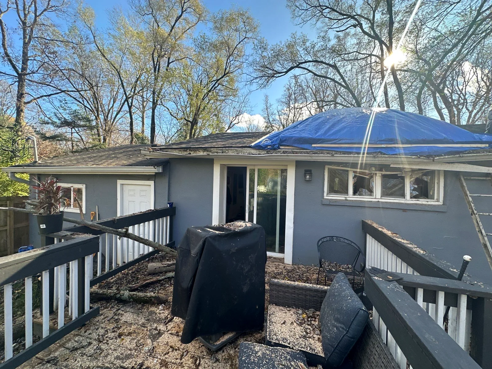
- Severe thunderstorms with straight-line winds. 60-80+ mph winds remove shingles, damage roof flashing, drive rain into building envelopes, and knock down trees. By far the most common cause of property damage in our region.
- Large hail. Quarter-size to baseball-size hail damages roofing, siding, gutters, AC condensers, and skylights. Hail damage is often subtle: you may not see it until a proper inspection.
- Tornadic events. Hamilton County is in tornado alley's northern reach. EF0-EF2 events are most common; EF3+ events have occurred. Tornado damage is typically obvious; the restoration challenge is scale and timing.
- Flash flooding. Heavy rainfall overwhelms drainage, driving water into basements and crawl spaces. Sump pump failures during these events are extremely common.
Pre-season property prep (do this in March)
- Test your sump pump. Pour 5 gallons of water into the pit. Pump should activate and discharge. Listen for unusual sounds. If it's 7+ years old, replace it preemptively before spring storm season.
- Install or verify a backup sump pump. Battery-powered backups run when power fails during storms. Water-powered backups (using municipal water pressure) run even when batteries die. Both are inexpensive insurance.
- Inspect your roof. Either climb up (carefully) or hire an inspector. Look for lifted shingles, damaged flashing, gutters pulling away from the fascia. Repair before storm season.
- Clean gutters. Clogged gutters drive water under roofing and into siding. Single biggest preventable cause of fascia and soffit damage.
- Trim trees near the house. Anything with branches over the roofline is a risk in high winds. Anything with branches near power lines is the utility's job, but you should still flag it.
- Check your insurance coverage. Specifically: water/sewer backup endorsement, wind/hail deductible, dwelling replacement cost. See our homeowner policy reading guide.
- Photograph your home from all angles. Pre-storm condition baseline. If you have a claim later, these photos prove what was undamaged before.
When the watch / warning is issued
The National Weather Service issues watches (conditions are favorable) and warnings (storm is imminent or occurring). When you see either for Hamilton County:
- Move outdoor furniture, grills, and loose items inside or against the house
- Park vehicles in garages where possible, hail damage to cars is expensive and rarely covered without comprehensive auto coverage
- Charge phones and have flashlights accessible, power outages are common
- Confirm your safe interior location (basement or interior windowless room) if a tornado warning is issued
- Don't go outside to "watch the storm", wind-driven debris is a major injury cause
Immediately after the storm
- Stay away from downed power lines. Assume every wire is live. Call the utility.
- Photograph all damage before moving anything. Roof damage, broken windows, fallen trees, interior water intrusion.
- If the roof is open and it's raining, place buckets and tarps over indoor items if you can do so safely. Do not climb on the roof yourself.
- Call us for emergency tarping and board-up. We respond within 2 hours, 24/7.
- Do not sign anything with door-knocking "storm chasers." Out-of-state contractors flood Hamilton County after every event. Many take deposits and disappear. See our storm damage page for the full warning.
- Notify your insurance. Most carriers prefer prompt notification (within 24-48 hours).
If you're in our service area and storm damage just hit your property
Call us: (812) 441-4814. We'll be on-site within 2 hours with emergency tarping, board-up, and water mitigation. Free assessment. Insurance billed direct.